

Over 70,000 Acres of Washington Trust Lands Gone: A Resource and Control Story
How Big Tech is influencing the loss of working lands.


A confidential source with deep, ongoing involvement in Washington’s Trust Land Transfer (TLT) program shared concerns privately. This individual has participated in TLT revitalization efforts and advisory processes for years. They have advocated for trust beneficiaries—public schools, counties, and other entities reliant on land revenue—while noting that some transfers serve legitimate purposes. Many others, however, raise questions about fiduciary responsibility and long-term outcomes.
Years ago, this source calculated a net loss of roughly 52,000 acres. DNR initially disputed the figure. Later official reporting on TLT revitalization acknowledged a net loss closer to 70,000-plus acres. Since 1989, more than 130,000 acres of state trust lands have been transferred out of revenue-producing status. Replacement acquisitions have significantly lagged, leaving a substantial gap in the productive land base that once supported timber, grazing, and other income for beneficiaries.
The TLT program, established in 1989, aimed to address “underperforming” parcels—those limited by access issues, legal constraints, or ecological sensitivities—by moving them into conservation, tribal, or public stewardship. Proceeds were intended to fund higher-performing replacement lands. In theory, the trusts would remain whole or strengthen. In practice, the revenue-generating land base has contracted. Recent legislative actions (2025-27 biennium and 2026 supplemental) continue funding transfers, including thousands of acres to the Yakama Nation (Tract C projects) and other tribal and conservation recipients.
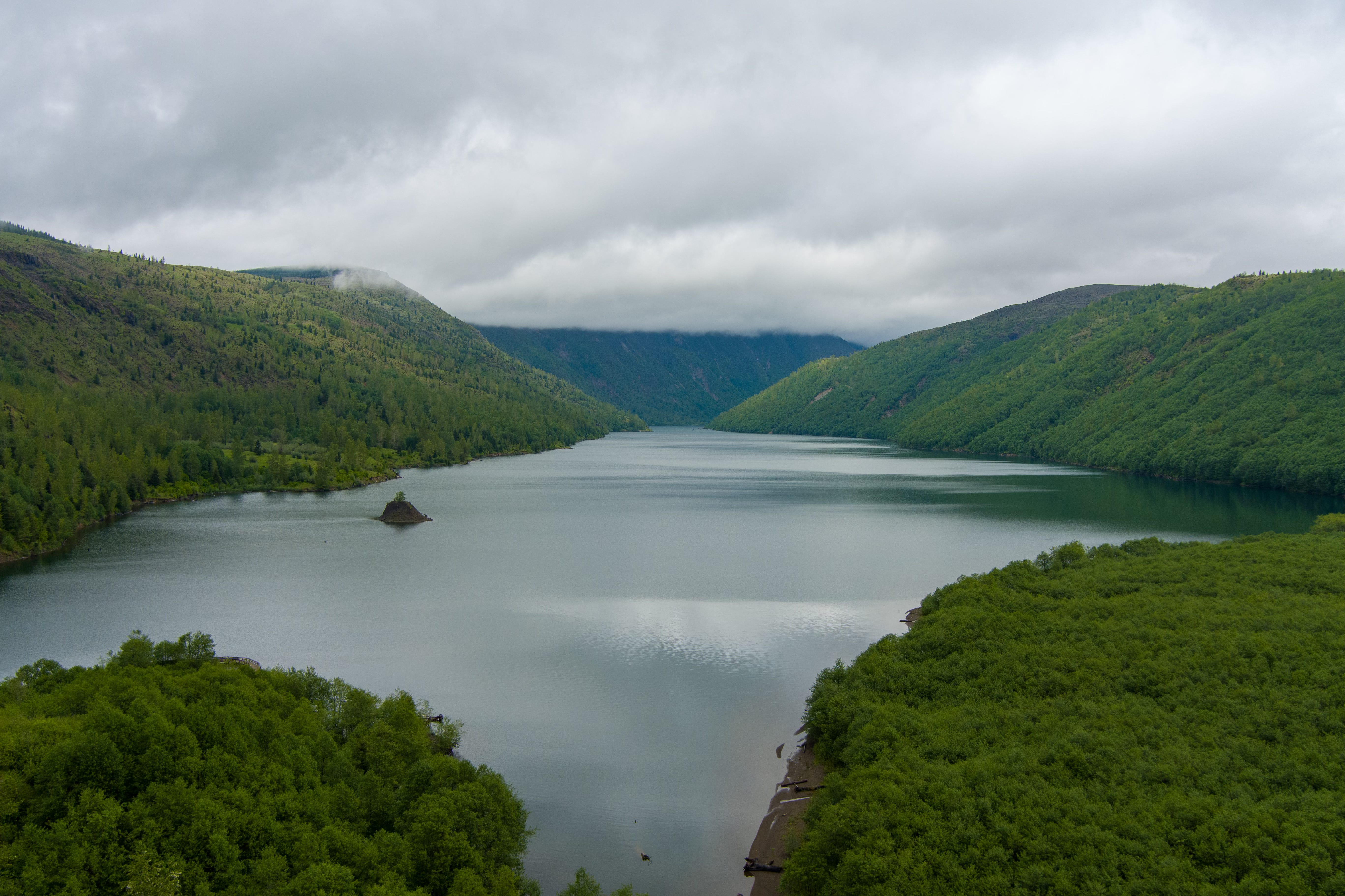
Insiders highlight cases that test the program’s balance: projects in Clallam County, Tri-Cities landbank efforts, and the high-profile King Ranch situation in Grant County. The latter involves roughly 12,800 acres of shrub-steppe habitat around Park Lake, long under grazing leases and still proposed via TLT for transfer to the Confederated Tribes of the Colville Reservation. Public comments closed in mid-April 2026 amid strong local opposition focused on lost agricultural productivity, recreation access, county tax base, and the shift from revenue-focused management.
This is not a simple “cowboys versus Indians” story. The “Land Back” narrative offers emotional and political appeal, but the deeper dynamics involve resources, jurisdiction, and influence across the Columbia River system—one of North America’s most vital and contested waterways.
Water Rights: Priority and Functional Influence
The Confederated Tribes of the Colville Reservation hold senior water rights under the Winters Doctrine, with priority dates from the 1870s. These federally protected rights support present and future needs—including fisheries, habitat, and cultural uses—and sit at the top of the allocation ladder during shortages. The reservation’s location along the upper Columbia River and Lake Roosevelt provides geographic leverage over hydropower operations, irrigation, fish passage, and cross-border flows. “Treatment as a State” status under the Clean Water Act adds regulatory authority to set and enforce water quality standards that can influence upstream activities.
Similar senior treaty rights give the Yakama Nation significant influence in the Yakima River Basin, a highly productive yet chronically over-allocated agricultural region. State agencies must deliver Clean Water Act compliance while navigating these priorities. Federal trust responsibilities further shape the environment. The result: strong incentives for visible, measurable progress on habitat and water quality—outcomes that conservation transfers and tribal stewardship can often demonstrate more readily than dispersed working lands.
In 2021, the state directed DNR to examine returning certain lands to tribes. This was formalized in the 2023 TLT revitalization. Yet the overall trust land base has continued shrinking. Meanwhile, HB 2544 (2025-26) established a pilot process for general water rights adjudication in the Upper Columbia River area (including Lake Roosevelt territory overlapping Colville influence). The process prioritizes significant federal and tribal claims first, adding urgency to allocation clarity in a basin already under competing pressures.
The Eastern Washington Buildout: Power, Compute, and Finite Water
Eastern Washington has rapidly emerged as a data center and energy infrastructure hub. Central Washington’s data center capacity has grown sharply, with Amazon Web Services advancing a multi-billion-dollar campus at Wallula Gap (more than 550 acres purchased for roughly $36 million, plans for 16 data centers). Additional activity continues in the Richland/West Richland corridors. Utility-scale solar, battery storage, and the federally licensed Goldendale Energy Storage Project in Klickitat County—a closed-loop pumped hydro facility using Columbia River water for initial fill (7,640 acre-feet) and ongoing make-up (roughly 360 acre-feet per year)—cluster in the same corridors. Transmission upgrades support the expansion.
These facilities require reliable power and water. A typical hyperscale data center can consume 300,000 to 5 million gallons per day for cooling—equivalent to the daily water needs of a town of 10,000 to 50,000 people. In Eastern Washington’s irrigation-heavy Columbia Basin, that volume can match the daily irrigation demand of thousands of acres of farmland. New industrial load does not create water—it reallocates existing supply in a system already fully spoken for. Pumped hydro projects like Goldendale add further draw for initial filling, supplemental replacement, and operations.
A concrete example of this land-and-water shift is playing out at Wallula Gap itself. The Port of Walla Walla’s sale of former agricultural land to Amazon Data Services includes not only the 550+ acres for data centers but also explicit infrastructure: utility easements, rail access, and a dedicated four-inch domestic potable water line. The Port will negotiate a separate water-use agreement, drawing from its portfolio of Columbia River pumping stations, aquifers, and wells. Port officials have noted the project’s estimated water use would be less than current agricultural consumption on the same land—but the shift from farming to industrial cooling still reallocates finite supply in a fully allocated basin. Residents have raised concerns about long-term impacts on local water sources.
Bonneville Power Administration load forecasts and Northwest Power and Conservation Council projections highlight steep energy demand growth from data centers and related infrastructure. Governor Ferguson’s 2025 Data Center Workgroup and related studies underscore the pressures. Ongoing water rights adjudications and reports from groups like Columbia Riverkeeper highlight the strain, noting data centers’ role in reshaping energy and water priorities across the basin.
The System: Converging Incentives, Not a Single Plot
Land near water—riparian zones, wetlands, headwaters—does not equal formal water rights ownership. It does create functional influence over management through habitat standards, flow expectations, species protections, and temperature requirements. Federal environmental frameworks reward measurable outcomes on impaired waters. Tribes, as sovereign regulators, and conservation entities become natural partners for delivering those results. Working agricultural lands often face more dispersed compliance challenges.
TLT and similar tools can act as pressure valves. Regulatory or enforcement actions may classify lands as underperforming. Transfers then shift them into stewardship categories aligned with compliance goals. This pattern—pressure, devaluation, transfer, management shift—does not require secret coordination. It emerges from independently aligned incentives: state agencies avoiding litigation, federal trust obligations, tribal sovereignty and stewardship priorities, conservation mandates, and corporate needs for predictable regulatory environments amid explosive AI-driven demand.
Efforts to increase transparency—such as House Bill 2515, which sought broader data center reporting on energy and water use—stalled in the Senate after industry pushback. A narrower measure (SB 5982) passed with more limited requirements, leaving broader visibility into resource impacts constrained.
Tribes pursue legitimate sovereign interests in habitat, culture, and authority. Many tribal members and the public may not see the full upstream picture: how productive agricultural land quietly exits the revenue base, how allocation priorities harden, and how infrastructure clusters reshape rural corridors. Rural school districts, which rely heavily on trust land revenue, have voiced concerns over declining or disrupted income streams. Broader warnings from groups like the American Forest Resource Council note that timber sales have hit 22-year lows and that removing or setting aside tens of thousands of additional acres could mean up to $2 billion in lost revenue to beneficiaries over the next two decades—directly affecting schools, counties, fire districts, libraries, and hospitals.
This reflects systems-level architecture—federal laws, funding streams, ecological policies, and economic pressures converging precisely when data centers, renewables, and grid storage demand stability in a stretched landscape. “Land Back” rhetoric provides cover, but the outcomes suggest broader reallocation of influence over the Columbia system.
Who benefits in practice? Tech and energy developers gain capacity for the AI economy. The state advances environmental targets and reduces legal risks. Tribes expand stewardship. Conservation groups secure acres. Trust beneficiaries lose productive land from the revenue-generating portfolio. Irrigators and rural economies face tighter supplies. The public sees working agricultural landscapes shift toward industrial-scale energy and digital infrastructure.
The 70,000-plus acres are gone. Key questions persist: What exactly replaced them in the trust portfolio? How do transfers intersect with water adjudications like the Upper Columbia pilot, infrastructure siting (including projects like Wallula Gap and Goldendale), and jurisdictional shifts? Greater transparency on appraisals, replacements, cumulative impacts, and decision processes would help the public determine whether the TLT program is truly optimizing long-term revenue for schools and communities—or quietly facilitating a larger reallocation of the West’s scarcest resources.